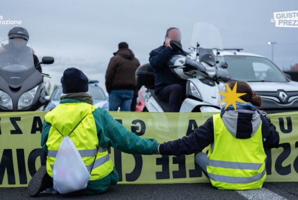
By Gracia Ramirez and David Vergara-Moreno
This photo essay looks at Isla Grande, the largest coralline island of Nuestra Señora del Rosario Archipelago, which is part of the Parque Nacional Natural Corales del Rosario y de San Bernardo, in the Colombian Caribbean. The essay considers the environmental beauty and the violence that underpin Black lives on the island, and the ways in which they have resisted as a community to go forward into the future.
DOCKS
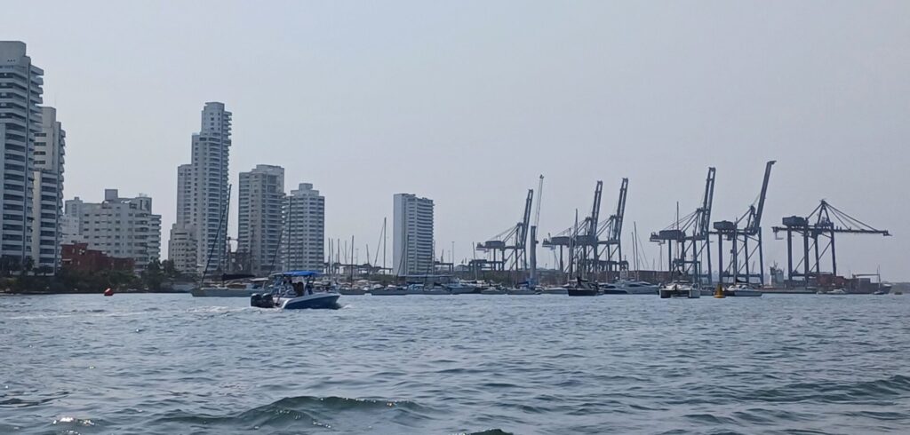
La Bodeguita dock in Cartagena de Indias is the tourists’ gateway to the promised paradise of white-sand beaches and turquoise waters of the Rosario Islands. The docks and other hard boundaries of the port witness an encounter with the polluted waters around Cartagena. This port is responsible for 70% of the country’s maritime trade and has been categorized as the third most efficient port in the world.
Although rarely mentioned by the early chroniclers, it is reasonable to infer that —prior to and during the early centuries of colonization— Cartagena’s Bay was a lush mosaic of abundant coral reefs, dense mangrove forests, and towering tropical dry forest trees.
Today, however, the bay reveals another face: murky waters, laden with sediments, polluted by centuries of maritime traffic, urban and industrial waste, and dredging works that have radically transformed its ecological cycles.
While the departure of tourism to the islands is mainly managed from La Bodeguita dock, the journey out of the bay and into the sea allows visual contact with other docks along the coast.
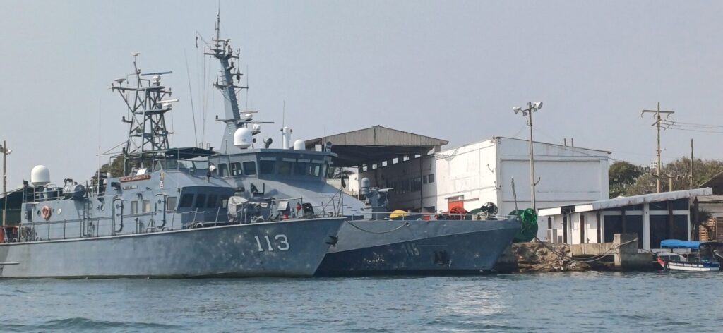
This is a layered cartography of memories, economies, and spatial regimes: tourist piers, logistical cargo yards, shipyards, naval bases, and private marinas. The bay is not merely a coastal landscape, it is a friction zone between multiple socio-economic and political logics: tourism, military operations, goods trade, and the communities whose ways of life are subordinated to those regimes. This is a liquid frontier: a place of circulation, exclusion, and resistance.
-

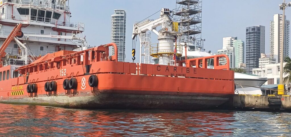
- Barge vessel used for fuel transport and logistics in the port of Cartagena. Photo by Gracia Ramirez.
-

- High rises and rigs in the Cartagena Bay. Photo by Gracia Ramirez.
-

- Military ships in the Cartagena Bay. Photo by Gracia Ramirez.
LOGISTICS
The archipelago of the Rosario Islands is connected not just to the Atlantic but also to another body of water, the Canal del Dique. The Spanish colonizers began its construction in the 16th century using enslaved Indigenous and African labor, with the goal of linking the Magdalena River —the nation’s main fluvial artery— with the Cartagena Bay.
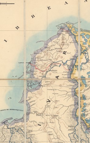
Map of the Northern part of Bolívar Department, Republic of Colombia 1886-1903 (Edward Stanford, 1899, cropped). It is possible to see Cartagena de Indias, Barú island below, the Canal del Dique and the Calamar-Cartagena Railway (red line). Source: Mapoteca Biblioteca Nacional de Colombia.
Since then, the Canal has played a strategic role in both domestic and foreign transport and trade, evolving from wooden barges in the 17th century, to the advent of steam-powered boats in the 19th century.
For over three centuries, the Magdalena River and its canal were the only connection between Colombia’s Caribbean and its Andean provinces, linking a nation divided by three mountain ranges and a wide variety of thermal floors and ecosystems. Socially, the Canal became the route to freedom, as many runaway enslaved people (cimarrones) followed its waterways and founded Maroons communities (palenques) in the surrounding wetlands and hills during the 17th and 18th centuries.
Until the late 19th century, the Dique was merely a narrow, shallow ditch less than 15 meters wide, which was impossible to navigate during droughts. But throughout the 20th century, the canal was radically transformed. U.S. companies carried out major dredging and straightening projects that widened it to 100 meters, reducing its original 270 meanders to only 55, dramatically increasing its flow and sediment loads, altering the ecological balance of Cartagena and Barbacoas Bays and surroundings.
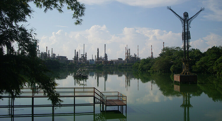
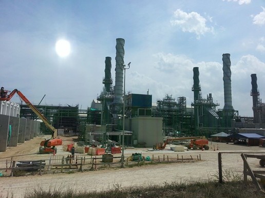
Despite these efforts, the canal became almost obsolete after the construction of two major highways that linked the Caribbean to the Andean region of the country in the 1950s. However, around the same time, Colombia’s largest oil refineries were established in Barrancabermeja and Cartagena.
As human geographer Austin Zeiderman argues, such infrastructures articulate geo-racial regimes and hierarchies of white and black, urban and peripheral, central and insular, that become sedimented into both Cartagenian landscapes and bodies.
-

- Oil refineries in Barrancabermeja (Santander) behind the figure of Cristo Petrolero. Wikimedia Commons.
-

- Cartagena Refinery. Photo by William Buitrago.
MATERIALS
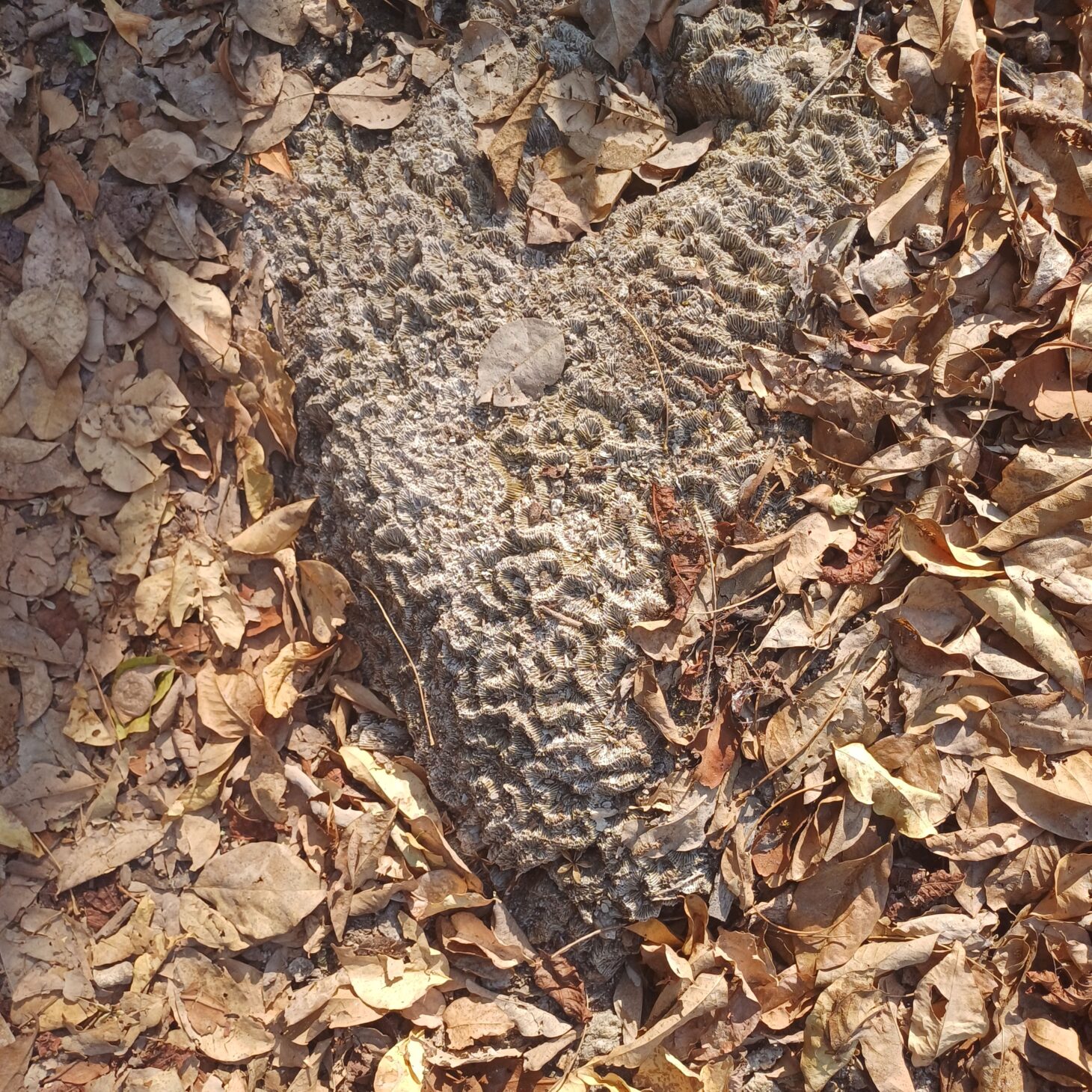
Excavations on the ground reveal the coralline stone, compacted after centuries of pressure and erosion. Isla Grande is a coral reef fossil itself. Coral reefs are vital ecosystems: they protect shorelines from storms, sustain local fisheries, support biodiversity, and form the ecological backbone of a tourism industry that underpins much of Cartagena city’s economy. Yet their very skeletons have been quarried and consumed. Entire islets were built for elite leisure by filling the sea with broken coral, the moneyed class literally manufacturing new islands from the bones of the reef.

Coral grounds. Photo by Gracia Ramirez.
The Canal del Dique continues this slow and silent violence. Each rainy season, it expels plumes of sediment-laden freshwater that spread across several square kilometers, covering turquoise waters with brown stains. These pulses reduce salinity and block light, suffocating photosynthesis and interrupting coral reproduction cycles that coincide with the wet months. In fact, the deposits of sediment have turned the formerly island of Barú into a peninsula, following the interventions of USA engineering companies in the twentieth century.
The history of Isla Grande is intimately linked to that of Barú. Around the time of the Spanish colonization, these territories were called Bahaire after the indigenous chief that ruled them before the conquest. The Spaniards used enslaved labour to excavate quarries in Barú and Tierra Bomba, extracting coralline stone used in Cartagena’s colonial architecture. They also built kilns to burn coral stone, producing mortar for the city’s fortifications and lime for its characteristics whitewashed walls.
In the eighteenth century, the nearby island of Barú became a strategic point for cimarrones and Dutch and English smugglers who used enslaved workforce for the logistics related to trafficking. Some enslaved workers, in turn, were secretly saving money to buy their freedom to their masters –mostly Spaniards–.
Over the nineteenth century, with the crisis of slavery and the independence wars, Barú became an instance of a horizontal community formed mostly by cimarrones, freed slaves and mestizos. Their economy was based on subsistence agriculture, fishing, bartering and mutual support.
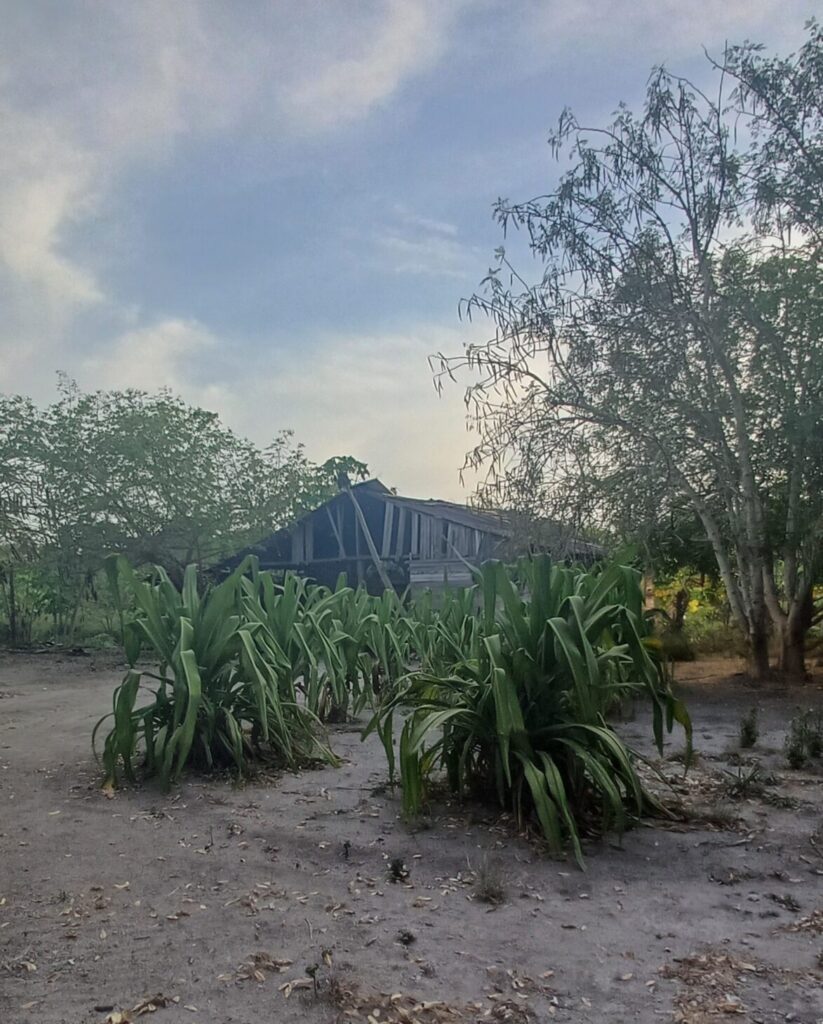
Wooden house. Photo by Gracia Ramirez.
On June 7 of 1850, groups of neighbours from Barú bought an old hacienda to its then owner for 1.200 COP and finished their payment on May 19, 1851. Just two days later, the abolition of slavery was signed in the country. Thus, Barú become a Black community with collective property before the establishment of the modern-day Republican State. Coconut became the main crop and some families from Barú moved to the neighbouring Rosario Islands to extend the plantations.
Islander dwellings echo this layered material history. Traditional houses rely on wooden boards and palm-thatched roofs, fragile yet renewable. Modern constructions import thin red bricks and cement from the mainland, materials that, as they degrade, seep into the calcareous soil and alter its composition.
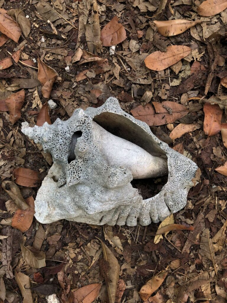
Seashell. Photo by David Vergara.
Cement itself is ambivalent: it raises luxury resorts that displace the community, yet it also fortifies schools and homes through collective labor. In their very texture, these materials tell two stories at once—of extraction and restriction, but also of resilience and re-creation.
ORIKA
Right at the centre of Isla Grande is now the town of Orika. An old rubber tree guards the town’s square and provides shelter from the sun. The Cultural House is the gathering place where local council meetings (juntas) take place. The story of Orika is one of socioecological struggle and resistance.
Over the twentieth century, Barú started supplying agricultural goods to the growing Cartagena population, shifting toward intensive production of coconut, fish and mangrove charcoal. Up until the 1950s –when roads were constructed to connect Cartagena with other inland cities– the Rosario islands and Barú were the main providers of food sold at the city’s Getsemani market.
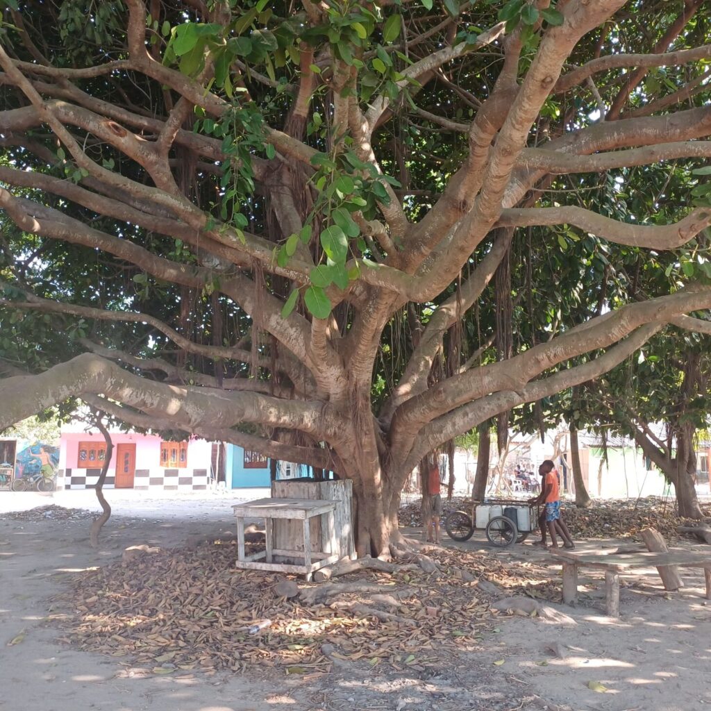
Rubber Tree in Benkos Biohó Square, Orika, Isla Grande, PNNCRSB. Photo by Gracia Ramirez.
The first tourists were members of Cartagena’s urban elite. They arrived at the Rosario Islands between the 1930s and 1940s and started building recreational homes. While tourist infrastructure was consolidating around Cartagena and the islands, a beetle plague destroyed the coconut plantations in the 1950s.
In order to “protect” the islands, the government declared them National Natural Park in 1977, but the National Park mainly considered the sea, not the ground islands themselves. The decree sought to “conserve flora, fauna, landscapes, and historical and cultural manifestations with scientific, recreative or aesthetic goals”, but omitted any mention of the Blacks communities that already inhabited the territory (Rosario Islands, Barú, Santa Ana and Ararca).
-

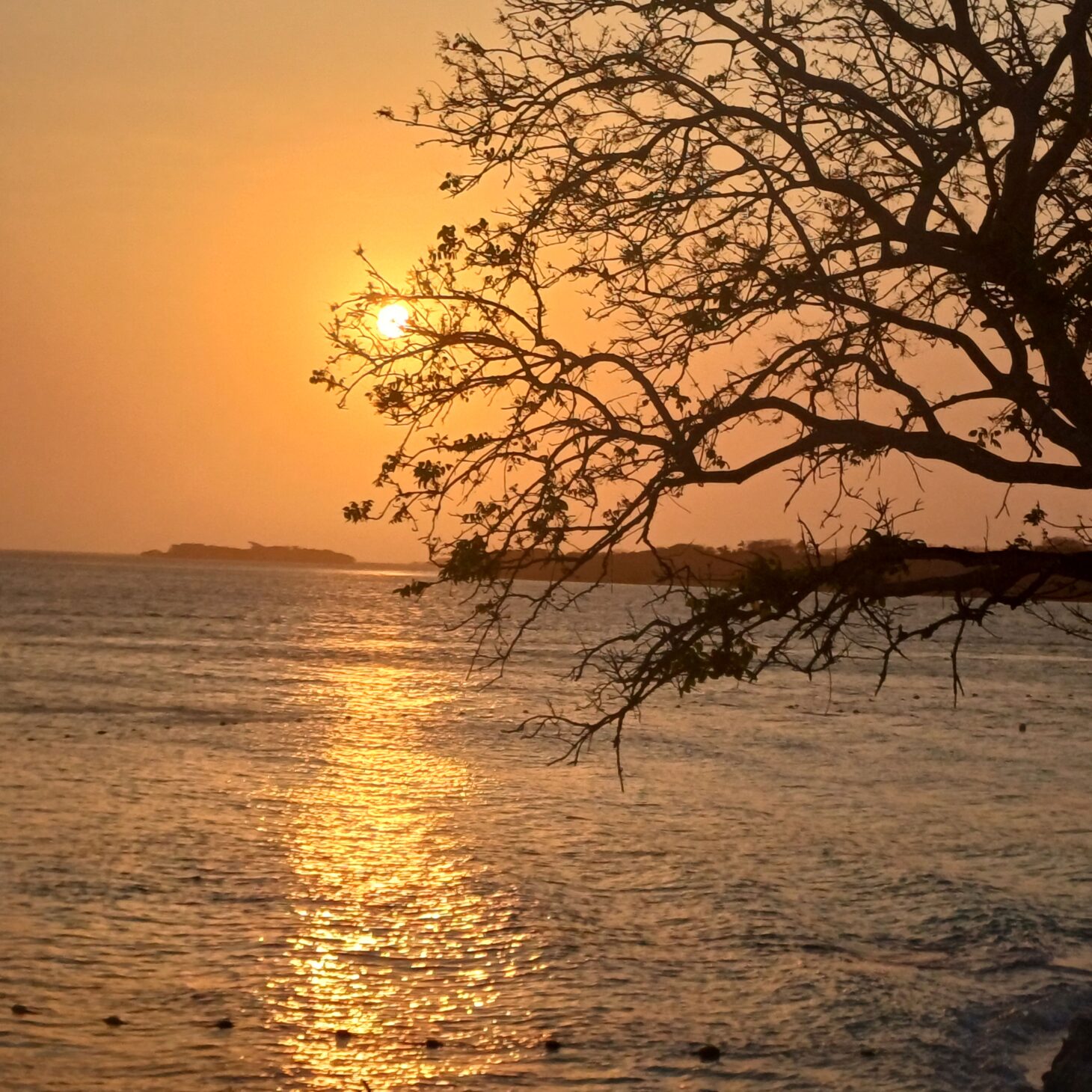
- Sunset in Isla Grande. Photo by Gracia Ramirez.
-
- Young Bonga Tree. Photo by Gracia Ramirez.
New prohibitionist environmental policies, coupled with the rise of tourism, relegated local families to the hinterlands of Isla Grande and to the backs of hotels and resorts, where they worked as subordinate labor.
In the 1980s, the government declared the Rosario Islands to be State-owned vacant lands, unrecognising the community as a “organized population” for the use of land but allowing other economical uses such as tourism and recreation. This enabled a wave of land grabs by private investors that further marginalised the community. However, the 1991 Constitution and the ensuing law 70 of Black Communities of 1993 provided legal tools to transform the memory of dispossession into a fight for recognition.
The community used environmental education programs to strengthen social organizations and articulate their historical demands into a juridical argument. In 2001, after years of legal limbo, the Colombian state began the land restitution process.
Fearing expulsion from the territory, the families decided to establish a new village in the center of Isla Grande: Orika, in honor of the daughter of Benkos Biohó, a cimarron leader and hero of San Basilio de Palenque, the first Black free village in the Americas (1714). In just two months, the community cleared the land and built their houses, a gesture of dignity and memory, affirming their right to exist as a Black community in their ancestral territory. After collecting evidence and going through endless administrative hurdles, in 2014 the Constitutional Court recognized the collective deed title for the Black community of Isla Grande, becoming the only community having achieved that so far within the national park.
UNBOUNDEDNESS
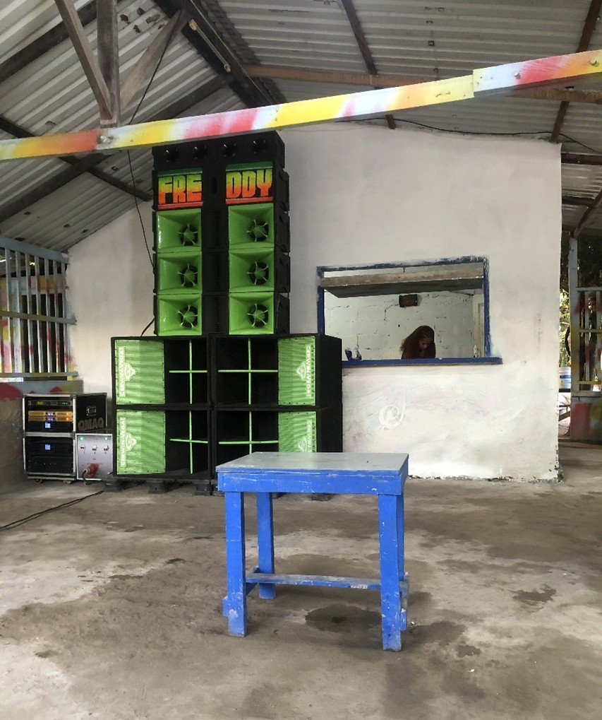
Sunset horizons and native trees may meet the tourist’s gaze as landscapes ready for easy consumption— postcards of “untouched nature.” Yet the town of Orika unsettles this commodified view. Its soundscape resists containment: sound systems (picós) blasting loud music reverberates from the main square, echoing through every coralline ground cavity, vibrating as much in bodies as in stone.
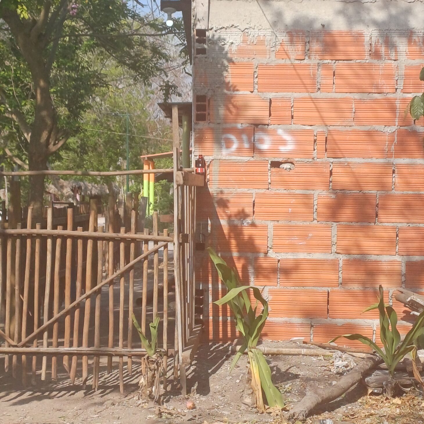
In language, too, survival leaves its trace. The word Dios circulates as the name of the Christian god, but within it hides the untranslatable presence of African spirits, invoked yet unconfined by letters. This is not syncretism as tourist folklore, but the deep mimicry of African cosmologies that persisted beneath colonial surveillance.
In the Colombian Caribbean, enslaved Africans lived not in the vast monocultures of the sugar plantations of Brazil or Cuba, but in smaller, multiethnic communities tied to haciendas, cattle ranches, mines, and urban centres under the close watch of the Inquisition tribunal of Cartagena.
Cut off early from eighteen century renewed arrivals of African captives, these populations developed distinctive spiritual practices, an instance of what Sylvia Wynter called “black indigenization”— that in intertwining African, indigenous, and Christian forms, found ways of being human when colonial hegemony ruled otherwise.
Orika inhabits this layered spiritual geography. It is not simply a village bounded by its streets, but a porous space where music, light, and faith exceed enclosure—an unlimited terrain of survival, memory, and reinvention.
-

- Sound system (picó). Photo by David Vergara.
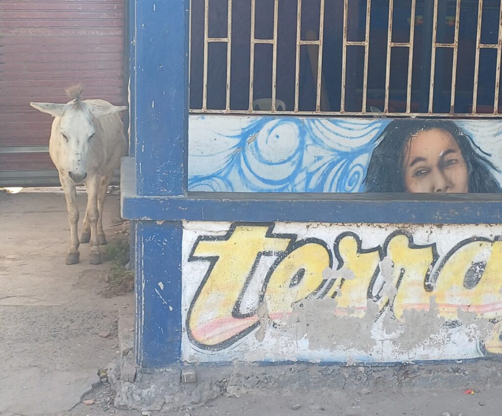
-
- Graffiti in Orika buildings. Photo by Gracia Ramirez.
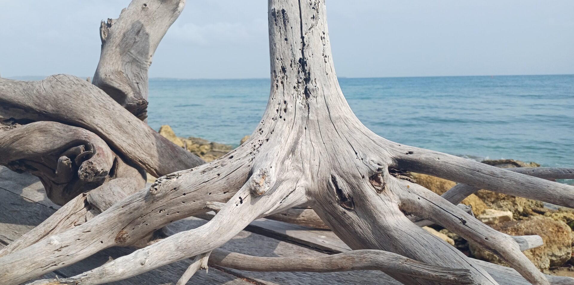
ROOTS
Mangrove forests form the living roots of Isla Grande. They are among the most resilient trees on Earth—thriving where others would perish. Their bodies adapt to saline soils and shifting tides, standing firm where land is not yet land.
Propagules germinate while still attached to the parent tree, dropping into the water as living seedlings that drift across lagoons and channels, anchoring themselves wherever conditions allow. Each root is a promise of survival, each forest a nursery that shelters fish, crabs, and birds in any of their stages of life. Mangroves breathe through aerial roots that rise above the mud, searching for oxygen in conditions too harsh for most species. Always green, they embody endurance.
The mangrove is never alone. Its leaves, roots, and fallen branches decompose into nutrients that sustain fish and crustaceans; its tangled roots interlace with seagrass meadows and coral reefs in a single inter-ecosystemic web. Together, these systems form the ecological triangle of the Caribbean coast: corals buffer waves, seagrasses filter and stabilize sediments, mangroves hold the shoreline while feeding both sea and land. In Isla Grande, these roots not only prevent erosion but also connect the island’s fragile ecology to Cartagena’s coastal mangroves, weaving life across waters.
For Orika, the mangrove is more than ecology—it is a metaphor for community. Like the red mangrove that elevates itself above its roots, the people rise from centuries of exclusion, rooted yet expansive. Their history drifts like propagules, carried by tides of resistance until finding ground to grow.
The mangrove teaches resilience, interconnection, and renewal: lessons for a community that continues to defend its territory while imagining futures where culture and ecology flourish together. Roots here are not only in soil, but in memory and struggle, anchoring Orika to both the Caribbean Sea and to its own unfolding horizon.
-

- Dry mangrove roots. Photo by Gracia Ramirez.
-

- Mangrove (right) next to tropical dry forest. Photo by David Vergara.
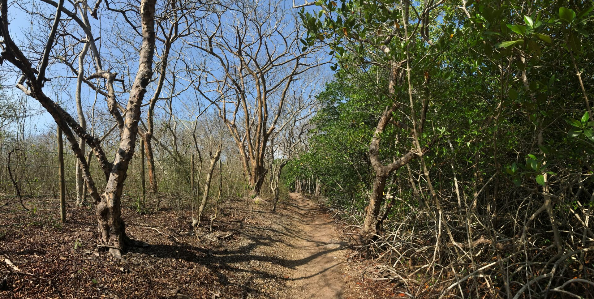
DRIFT
There are no roads in Isla Grande, only sandy footpaths weaving through the tropical dry forest and the mangroves. No motorized vehicles circulate within the island, people walk or ride bicycles, while boats and yachts, arriving from Cartagena, leave trails of oil shimmering over the turquoise surface.
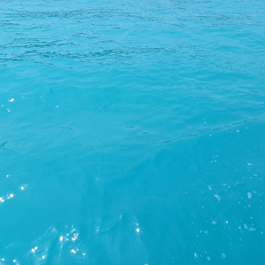
Caribbean Sea water around Isla Grande. Photo by Gracia Ramirez.
Plastic bottles and rubbish drift ashore, carried by tides that remember more than the islanders would wish. Drift here is both material and historical: traces of empire, slavery, tourism, and extraction wash against the reef, staining waters once clear. The islands themselves are a coral body in constant erosion and recomposition, a living drift of stone, memory, and survival.
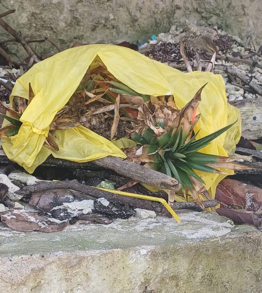
Plastic and vegetable waste. Photo by Gracia Ramirez.
Yet drift is not only decline—it is also possibility. Orika, born out of dispossession, has become a node of reorganization and creativity. The community council anchors collective life, negotiating with agencies and hotels that now contribute resources for communal projects.
Every weekend, and on national and local holidays, happiness brightens the whole town in shared spaces like the main Plaza (Benkos Biohó Plaza), the picós, the cockpits, houses and the Casa Cultural. A new foundation works with children and youth, teaching them to stage traditional dances and music, reweaving ancestral ties to the palenques and to African rhythms long suppressed.
Ecotourism initiatives, led by younger generations, form alliances with older community projects, offering alternatives that value culture and ecology together.
Buildings around Benkos Biohó Square in Orika. Photo by Gracia Ramirez.
Drift, then, also gestures toward a different horizon. In Orika, the tides carry not only the weight of history but also the seeds of futures yet to come. The Rosario Islands are a historical drift still evolving—where coral, memory, and community recombine into new forms of life.